
File:Croatia location map.svg

Dimensioni di questa anteprima PNG per questo file SVG: 619 x 599 pixel. Autra resoluzions: 248 x 240 pixel | 496 x 480 pixel | 793 x 768 pixel | 1 058 x 1 024 pixel | 2 116 x 2 048 pixel | 1 097 x 1 062 pixel.
Documënt uriginel (file tl format SVG, dimenjiuns nominales 1 097 × 1 062 pixels, dimenjiun dl file: 480 KB)
Ressumé
| Descriziun |
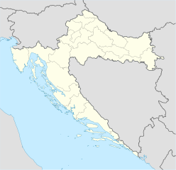
Deutsch: Positionskarte von Kroatien
Quadratische Plattkarte, N-S-Streckung 140 %. Geographische Begrenzung der Karte:
English: Location map of Croatia
Equirectangular projection, N/S stretching 140 %. Geographic limits of the map:
|
| Data | |
| Funtana | own work, using United States National Imagery and Mapping Agency data |
| Autur | NordNordWest |
| Altre versioni |
Derivative works of this file: |

|
Questa mappa è stata prodotta e/o migliorata nel Kartenwerkstatt, il laboratorio grafico della Wikipedia tedesca, dove è possible proporre mappe da migliorare.
|
Lizënza
Io, detentore del copyright su quest'opera, dichiaro di pubblicarla con le seguenti licenze:

|
AL é la lizënza da copié, da dé inant y/o müdé chësc documënt aladô dla lizënza GNU Free Documentation License, Verjiun 1.2 o vigni atra verjiun suandënta publicada dala Free Software Foundation; zënza seziuns che ara ne vá nia da mudé, zënza test söl cuertl ca dant y do ia. Na copia dla lizënza é tla seziun cun le titul Test dla GNU Free Documentation License. |
Chësc file á la lizënza de destribuziun aladô dla lizënza Creative Commons Attribution-Share Alike 3.0 Unported.
- Tu ies liede:
- da spartì – per cupié, spartësc y manda l lëur
- da mudé – da adaté al lëur
- A chësta condizions:
- atribuzion – Tu mues atribué l lëur te la maniera che à spiegà l autëur o chël che à la lizënza (ma nia te na maniera che l smea che ëi te paiessa).
- fá na condivijiun tla medema manira – Sce te mudes o svilupeies chësc test, pudres mé spartì ora l lëur sota la medema lizënza o una che ti smea a chësta same or compatible license
Pos chirí fora la lizënza che as plü ion
Storia dl documënt
Druca sun na data/ëura per udëi l documënt coche l fo te chël mumënt.
| Data/Ëura | Miniatura | Grandëza | utënt | Cumentar | |
|---|---|---|---|---|---|
| atuel | 10:00, 29 ago 2008 | | 1 097 × 1 062 (480 KB) | NordNordWest | |
| 17:54, 30 lug 2008 |  | 548 × 531 (412 KB) | NordNordWest | more detailed borderlines | |
| 18:55, 16 lug 2008 |  | 548 × 531 (454 KB) | NordNordWest | {{Information |Description= {{de|Positionskarte von Kroatien}} Quadratische Plattkarte, N-S-Streckung 140 %. Geographische Begrenzung der Karte: * N: 46.8° N * S: 42.1° N * W: 13.1° O * O: 19.9° O {{en|Location map of [[:en:Croatia|Cr |
Coche l document ie stat adurvà
Chësta 3 plates adroa chësc documënt:
Coche l documënt ie stat adurvà ntëur l mond
Ënghe chësta wikis adroa chësc documënt:
- Adurvà sun ab.wikipedia.org
- Adurvà sun af.wikipedia.org
- Adurvà sun als.wikipedia.org
- Adurvà sun am.wikipedia.org
- Adurvà sun an.wikipedia.org
- Adurvà sun ar.wikipedia.org
- قالب:خريطة مواقع
- قالب:خريطة مواقع كرواتيا
- قالب:خريطة مواقع/شرح
- بطولة أوروبا لكرة الصالات 2012
- قالب:خريطة مواقع/ملعب
- قالب:Location map/sandbox quick/doc
- وحدة:Location map/data/Croatia
- وحدة:Location map/data/Croatia/شرح
- اشتباك باكراتش
- حادثة بحيرات بليتفيتش
- معركة بوروفو سيلو
- حصار كييفو (1991)
- عملية العاصفة (حرب البوسنة والهرسك)
- Adurvà sun arz.wikipedia.org
- Adurvà sun ast.wikipedia.org
Mostra utilisaziun globala de chësc file.