File:Hammurabi's Babylonia 1.svg
Contenuti della pagina non supportati in altre lingue.
Da Wikipedia

Documënt uriginel(file tl format SVG, dimenjiuns nominales 655 × 570 pixels, dimenjiun dl file: 183 KB)

Chësc documënt ven da Wikimedia Commons y po unì adurvà per autri proiec. Dessot ie la descrizion te la file description page.

 
W3C-validity not checked.

Ressumé

Descriziun

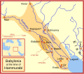
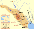
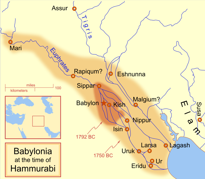
A locator map of Hammurabi's Babylonia, showing the Babylonian territory upon his ascension in 1792 BC and upon his death in 1750 BC. The river courses and coastline are those of that time period -- in general, they are not the modern rivers or coastlines. This is a Mercator projection, with north in its usual position

There is some question to what degree the cities of Nineveh, Tuttul, and Assur were under Babylonian authority. While in his introduction to his code of laws, Hammurabi claims lordship over these cities, Roaf does not include any of these in his map, upon which this map is based, and Chevalas states that "Assur and Nineveh were held for a very few years" (p. 155). Therefore, I have not included them as under Hammurabi's control in 1750 BC.
Data
Funtana Opera personala
Autur MapMaster
Altre versioni

[mudé]

See also

References

  • Bjorklund, Oddvar; Holmboe, Haakon; Rohr, Anders (1970) Historical Atlas of the World, Barnes & Noble, NY, SBN: 389-00253-4.
  • Chavalas, Mark W.; K. Lawson Younger (2003) Mesopotamia and the Bible, Continuum International Publishing Group, ISBN 978-0567082312.
  • Hammond World Atlas Corporation (2007) Historical World Atlas, ISBN 9-780843-71391-6
  • Roaf, M. (1990) Cultural Atlas of Mesopotamia and the ancient Near East, Oxford: Facts on File. (In general, the basis for the ancient river courses and ancient coastline).
  • Van De Mieroop, Marc (2005). King Hammurabi of Babylon: A Biography. Blackwell Publishing. ISBN 1405126604

Lizënza

Io, detentore del copyright su quest'opera, dichiaro di pubblicarla con le seguenti licenze:
GNU head AL é la lizënza da copié, da dé inant y/o müdé chësc documënt aladô dla lizënza GNU Free Documentation License, Verjiun 1.2 o vigni atra verjiun suandënta publicada dala Free Software Foundation; zënza seziuns che ara ne vá nia da mudé, zënza test söl cuertl ca dant y do ia. Na copia dla lizënza é tla seziun cun le titul Test dla GNU Free Documentation License.
w:it:Creative Commons
atribuzion fá na condivijiun tla medema manira
Questo file è licenziato in base ai termini delle licenze Creative Commons Attribuzione-Condividi allo stesso modo 4.0 Internazionale, 3.0 Unported, 2.5 Generico, 2.0 Generico e 1.0 Generico
Tu ies liede:
  • da spartì – per cupié, spartësc y manda l lëur
  • da mudé – da adaté al lëur
A chësta condizions:
  • atribuzion – Tu mues atribué l lëur te la maniera che à spiegà l autëur o chël che à la lizënza (ma nia te na maniera che l smea che ëi te paiessa).
  • fá na condivijiun tla medema manira – Sce te mudes o svilupeies chësc test, pudres mé spartì ora l lëur sota la medema lizënza o una che ti smea a chësta same or compatible license
Pos chirí fora la lizënza che as plü ion

Didascalie

Aggiungi una brevissima spiegazione di ciò che questo file rappresenta
Babylonian

Elementi ritratti in questo file

raffigura italiano

creatore italiano

Valore sconosciuto senza un elemento Wikidata

18 fau 2008

tipo di file italiano

image/svg+xml

Storia dl documënt

Druca sun na data/ëura per udëi l documënt coche l fo te chël mumënt.

(la plü nöia | la plü vedla) Ciara (10 plü nüs | ) (10 | 20 | 50 | 100 | 250 | 500)
Data/ËuraMiniaturaGrandëzautëntCumentar
atuel11:14, 21 aur 2013Miniatura de la version de la 11:14, 21 aur 2013655 × 570 (183 KB)CitypeekCleanup of file. Valid SVG now.
21:06, 27 aur 2010Miniatura de la version de la 21:06, 27 aur 2010655 × 570 (168 KB)DieBucheremoved border
17:05, 30 lug 2009Miniatura de la version de la 17:05, 30 lug 2009661 × 580 (317 KB)Amit6Some nodes changed.
01:24, 4 mer 2008Miniatura de la version de la 01:24, 4 mer 2008661 × 580 (163 KB)MapMasterAdded city-state, moved Sippar, minor other changes based on recent Kassite map
18:06, 23 fau 2008Miniatura de la version de la 18:06, 23 fau 2008661 × 580 (161 KB)MapMasterAdded 1 city, added name for 1 city
05:29, 21 fau 2008Miniatura de la version de la 05:29, 21 fau 2008661 × 580 (159 KB)MapMaster"blurred" the territory outlines
01:25, 21 fau 2008Miniatura de la version de la 01:25, 21 fau 2008661 × 580 (155 KB)MapMasterChanges made based on info from ''Mesopotamia and the Bible''
04:03, 19 fau 2008Miniatura de la version de la 04:03, 19 fau 2008663 × 580 (156 KB)MapMasterFixed an error on my part
23:12, 18 fau 2008Miniatura de la version de la 23:12, 18 fau 2008332 × 292 (156 KB)MapMastersome minor edits
21:19, 18 fau 2008Miniatura de la version de la 21:19, 18 fau 2008332 × 293 (154 KB)MapMasterremoved unrenderable bmp
(la plü nöia | la plü vedla) Ciara (10 plü nüs | ) (10 | 20 | 50 | 100 | 250 | 500)

Chësta plata adroa chësc documënt:

Coche l documënt ie stat adurvà ntëur l mond

Ënghe chësta wikis adroa chësc documënt:

Mostra utilisaziun globala de chësc file.

Metadac