
File:Havre De Grace Maryland Lighthouse 600.jpg
Havre_De_Grace_Maryland_Lighthouse_600.jpg (400 × 600 pixels, dimenjiun dl file: 99 KB, MIME type: image/jpeg)
Ressumé
|
Questa è un'immagine di un luogo o edificio che è elencato nel National Register of Historic Places negli Stati Uniti. Il suo numero di riferimento è [https://npgallery.nps.gov/AssetDetail/NRIS/76000999
. 76000999
.]. |
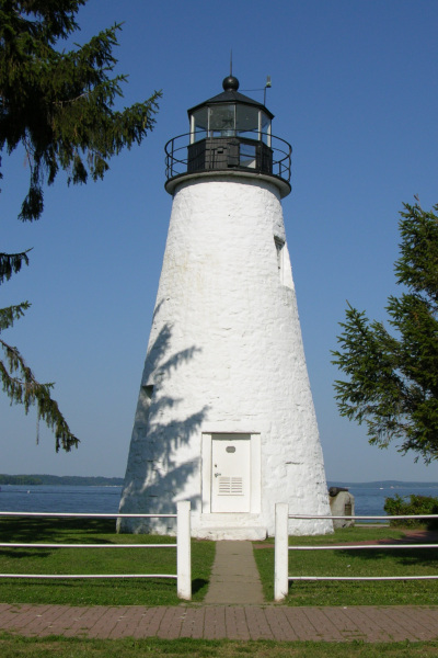
Picture of the Concord Point Lighthouse in Havre De Grace, Maryland overlooking the point where the Susquehanna River flows into the Chesapeake Bay. Photo by Derek Ramsey (Ram-Man)
Lizënza
You may NOT use this image on your own web site or anywhere else unless you release this image and any derivative works (which may include the web page or other medium where this image is used, if it is not considered a "collective work") by following the terms of one of the following licenses. Any other use will be considered a breach of copyright law. Please do not copy this image illegally by ignoring the terms of the license, as it is not in the public domain.
If you would like special permission to use, license, or purchase the image or prints of the image, or for use in any other fashion, or would simply like a copy of the original file, please contact me or email me first to ask. Please see the non-legalese usage guide for more information.
Note: While you are not required to do so by the license, please consider letting me know when you reuse one of my photograph images, as a courtesy.

|
È permesso copiare, distribuire e/o modificare questo documento in base ai termini della licenza GNU Free Documentation License, solo versione 1.2, come pubblicata dalla Free Software Foundation; senza sezioni non modificabili, nessun testo copertina, e nessun testo di retro copertina. Una copia della licenza è inclusa nella sezione intitolata GNU Free Documentation License. | 1,2 solo |
- Tu ies liede:
- da spartì – per cupié, spartësc y manda l lëur
- da mudé – da adaté al lëur
- A chësta condizions:
- atribuzion – Tu mues atribué l lëur te la maniera che à spiegà l autëur o chël che à la lizënza (ma nia te na maniera che l smea che ëi te paiessa).
- fá na condivijiun tla medema manira – Sce te mudes o svilupeies chësc test, pudres mé spartì ora l lëur sota la medema lizënza o una che ti smea a chësta same or compatible license
| Posizione del soggetto | | Posizione di questa e altre immagini su: OpenStreetMap |
|---|
Storia dl documënt
Druca sun na data/ëura per udëi l documënt coche l fo te chël mumënt.
| Data/Ëura | Miniatura | Grandëza | utënt | Cumentar | |
|---|---|---|---|---|---|
| atuel | 05:54, 17 lug 2005 | | 400 × 600 (99 KB) | Ram-Man | Picture of the Lighthouse in Havre De Grace, Maryland overlooking the point where the Susquehanna River flows into the Chesapeake Bay. Photo by Derek Ramsey ([[w |
Coche l document ie stat adurvà
Chësta plata adroa chësc documënt:
Coche l documënt ie stat adurvà ntëur l mond
Ënghe chësta wikis adroa chësc documënt:
- Adurvà sun ar.wikipedia.org
- Adurvà sun arz.wikipedia.org
- Adurvà sun ca.wikipedia.org
- Adurvà sun ceb.wikipedia.org
- Adurvà sun ce.wikipedia.org
- Adurvà sun cy.wikipedia.org
- Adurvà sun de.wikipedia.org
- Adurvà sun en.wikipedia.org
- Adurvà sun en.wikivoyage.org
- Adurvà sun es.wikipedia.org
- Adurvà sun eu.wikipedia.org
- Adurvà sun fa.wikipedia.org
- Adurvà sun fr.wikipedia.org
- Adurvà sun hu.wikipedia.org
- Adurvà sun it.wikipedia.org
- Adurvà sun ja.wikipedia.org
- Adurvà sun ky.wikipedia.org
- Adurvà sun nl.wikipedia.org
- Adurvà sun pl.wikipedia.org
- Adurvà sun pt.wikipedia.org
- Adurvà sun sco.wikipedia.org
- Adurvà sun sh.wikipedia.org
- Adurvà sun sr.wikipedia.org
- Adurvà sun tr.wikipedia.org
- Adurvà sun tt.wikipedia.org
- Adurvà sun uk.wikipedia.org
- Adurvà sun ur.wikipedia.org
- Adurvà sun uz.wikipedia.org
- Adurvà sun vo.wikipedia.org
- Adurvà sun www.wikidata.org
- Adurvà sun zh-min-nan.wikipedia.org
- Adurvà sun zh.wikipedia.org