
File:Old Georgia State Capitol.jpg

Dimenjiuns de chësta odüda danfora:800 x 543 pixel. Autra resoluzions: 320 x 217 pixel | 640 x 435 pixel | 1 024 x 696 pixel | 1 280 x 870 pixel | 2 560 x 1 739 pixel | 4 697 x 3 191 pixel.
Documënt uriginel (4 697 × 3 191 pixels, dimenjiun dl file: 2 MB, MIME type: image/jpeg)
| Luogo dello scatto | | Posizione di questa e altre immagini su: OpenStreetMap |
|---|
| Descriziun |
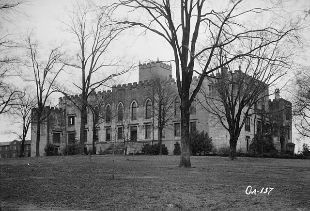
English: Old State Capitol, Milledgeville, Baldwin County, GA - General view. |
|||||
| Data | ||||||
| Funtana | Library of Congress, Prints and Photographs Division: Historic American Buildings Survey, HABS: GA,5-MILG,6-2 | |||||
| Autur | L. D. Andrew, photographer | |||||
| Lizënza (Tó ca danü chësc file) |
|


|
Questa image è disponibile presso la Divisione Stampe e Fotografie (Prints and Photographs Division) della Biblioteca del Congresso sotto l'ID digitale hhh.ga0306.
Questo tag non indica lo status del copyright dell'opera ad esso associato. È quindi richiesto un normale tag di copyright. Vedi Commons:Licenze per maggiori informazioni.
|
Storia dl documënt
Druca sun na data/ëura per udëi l documënt coche l fo te chël mumënt.
| Data/Ëura | Miniatura | Grandëza | utënt | Cumentar | |
|---|---|---|---|---|---|
| atuel | 17:00, 5 aur 2009 | | 4 697 × 3 191 (2 MB) | Cropbot | upload cropped version, operated by User:Finavon. Summary: border cropped |
| 04:31, 16 aur 2007 |  | 5 000 × 3 660 (2,19 MB) | Dual Freq | {{Information |Description=Old State Capitol, Milledgeville, Baldwin County, GA. (2. Historic American Buildings Survey L. D. Andrew, Photographer Jan 3, 1937 GENERAL VIEW HABS GA,5-MILG,6-2) {{coor dms|33|04|43|N|083|13|29|W|type:landmark}} |Source=[http |
Coche l document ie stat adurvà
L ne da deguna plates che adroa chësc documënt.
Coche l documënt ie stat adurvà ntëur l mond
Ënghe chësta wikis adroa chësc documënt:
- Adurvà sun ceb.wikipedia.org
- Adurvà sun de.wikipedia.org
- Adurvà sun en.wikipedia.org
- Adurvà sun es.wikipedia.org
- Adurvà sun fa.wikipedia.org
- Adurvà sun la.wikipedia.org
- Adurvà sun pt.wikipedia.org
- Adurvà sun sh.wikipedia.org
- Adurvà sun sr.wikipedia.org
- Adurvà sun uk.wikipedia.org
- Adurvà sun ur.wikipedia.org
- Adurvà sun zh-min-nan.wikipedia.org
- Adurvà sun zh.wikipedia.org