
File:West Germany 1956-1990.svg

Dimensioni di questa anteprima PNG per questo file SVG: 450 x 456 pixel. Autra resoluzions: 237 x 240 pixel | 474 x 480 pixel | 758 x 768 pixel | 1 011 x 1 024 pixel | 2 021 x 2 048 pixel.
Documënt uriginel (file tl format SVG, dimenjiuns nominales 450 × 456 pixels, dimenjiun dl file: 471 KB)
Ressumé


.svg)
.svg)
.svg)
.svg)
.svg)


.svg)
.svg)
.svg)


.png)
.png)


.svg)


.svg)

.svg)


.svg)
.svg)
.svg)
.svg)


.svg)
.png)


.svg)


.svg)
.svg)


.svg)


.svg)


.svg)
.svg)
.svg)
.svg)
.svg)
.svg)
.svg)
_cropped.svg)
.svg)
.svg)
.svg)
.svg)
.svg)
.svg)
.svg)
.svg)
.svg)
.svg)
.svg)
.svg)
.svg)
.svg)
.svg)
.svg)
.svg)
.svg)
.svg)
.svg)
.svg)
.svg)
.svg)
.svg)
.svg)
.svg)
.svg)
.svg)
.svg)
.svg)
.svg)
.svg)
.svg)
.svg)
.svg)
.svg)
.svg)
.svg)
.svg)
.svg)
.svg)
.svg)
.svg)
.svg)
.svg)
| Questa è una immagine ritoccata, il che significa che è stata modificata digitalmente dalla sua versione originale. Modifiche: {{{1}}}. La versione originale può essere vista qui: Blank map of Europe 1956-1990.svg.
|
Lizënza
Io, detentore del copyright su quest'opera, dichiaro di pubblicarla con la seguente licenza:
Chësc file á la lizënza de destribuziun aladô dla lizënza Creative Commons Attribution-Share Alike 3.0 Unported.
- Tu ies liede:
- da spartì – per cupié, spartësc y manda l lëur
- da mudé – da adaté al lëur
- A chësta condizions:
- atribuzion – Tu mues atribué l lëur te la maniera che à spiegà l autëur o chël che à la lizënza (ma nia te na maniera che l smea che ëi te paiessa).
- fá na condivijiun tla medema manira – Sce te mudes o svilupeies chësc test, pudres mé spartì ora l lëur sota la medema lizënza o una che ti smea a chësta same or compatible license
Registro originale del caricamento
This image is a derivative work of the following images:
- File:Blank_map_of_Europe_1956-1990.svg licensed with Cc-by-sa-3.0
- 2011-10-30T04:43:42Z Alphathon 450x456 (485146 Bytes) == {{int:filedesc}} == {{Information |Description={{en|Blank map of Europe showing national borders as they stood from 1956-1990.}} |Source=*[[:File:Blank_map_of_Europe.svg|]] |Date=2011-10-30 04:42 (UTC) |Author=*[[:File:Bla
Storia dl documënt
Druca sun na data/ëura per udëi l documënt coche l fo te chël mumënt.
| Data/Ëura | Miniatura | Grandëza | utënt | Cumentar | |
|---|---|---|---|---|---|
| atuel | 03:31, 28 sët 2018 | | 450 × 456 (471 KB) | FelipeRev | Se incluye Berlín Oeste pero con un color diferente, para marcar que pertenecía a su espacio económico |
| 06:04, 15 lug 2015 |  | 450 × 456 (476 KB) | Elevatorrailfan | Breaking apart West Germany and West Berlin paths. | |
| 03:43, 10 dez 2014 |  | 450 × 456 (476 KB) | Elevatorrailfan | West Berlin was not part of West Germany. | |
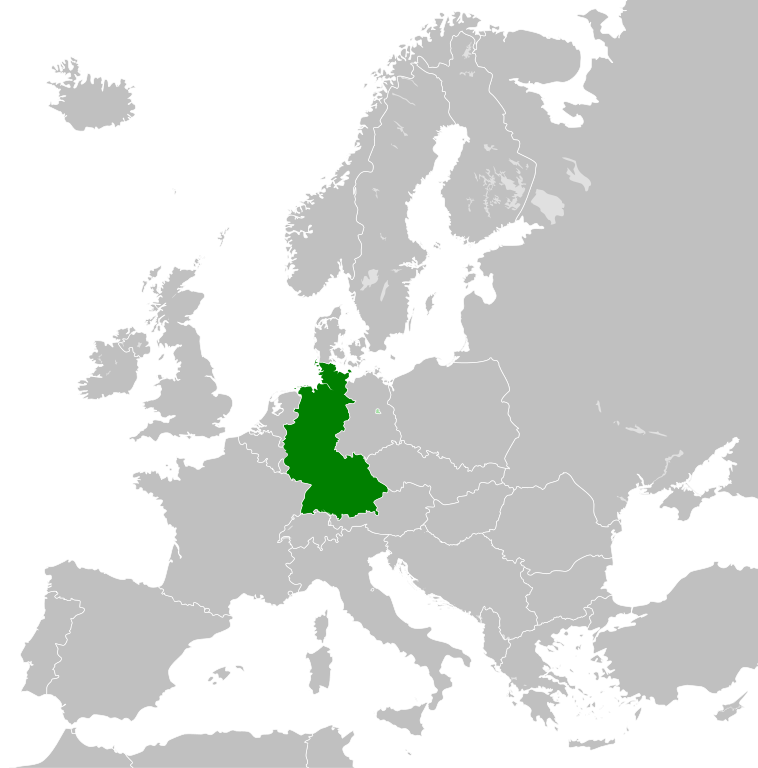
| 02:39, 26 nuë 2011 |  | 450 × 456 (474 KB) | StalwartUK | == {{int:filedesc}} == {{Information |Description={{en|Map of West Germany (Federal Republic of Germany) as it was from 1949-1990. Surrounding countries accurate from 1956-1990.}} |Source=*[[:File:Blank_map_of_Europe_1956-1990.svg|Bla |
Coche l document ie stat adurvà
Chësta plata adroa chësc documënt:
Coche l documënt ie stat adurvà ntëur l mond
Ënghe chësta wikis adroa chësc documënt:
- Adurvà sun af.wikipedia.org
- Adurvà sun an.wikipedia.org
- Adurvà sun ar.wikipedia.org
- Adurvà sun ast.wikipedia.org
- Adurvà sun be.wikipedia.org
- Adurvà sun bn.wikipedia.org
- Adurvà sun bs.wikipedia.org
- Adurvà sun ca.wikipedia.org
- Adurvà sun cs.wikipedia.org
- Adurvà sun da.wikipedia.org
- Adurvà sun el.wikipedia.org
- Adurvà sun en.wikipedia.org
- Adurvà sun eo.wikipedia.org
- Adurvà sun es.wikipedia.org
- Adurvà sun eu.wikipedia.org
- Adurvà sun fi.wikipedia.org
- Adurvà sun fr.wikipedia.org
- Adurvà sun fr.wiktionary.org
- Adurvà sun ga.wikipedia.org
- Adurvà sun gl.wikipedia.org
- Adurvà sun gv.wikipedia.org
- Adurvà sun ha.wikipedia.org
- Adurvà sun he.wikipedia.org
- Adurvà sun hi.wikipedia.org
- Adurvà sun hr.wikipedia.org
- Adurvà sun ia.wikipedia.org
- Adurvà sun id.wikipedia.org
- Adurvà sun io.wikipedia.org
- Adurvà sun it.wikipedia.org
- Adurvà sun ja.wikipedia.org
- Adurvà sun ka.wikipedia.org
- Adurvà sun ko.wikipedia.org
- Adurvà sun ku.wikipedia.org
- Adurvà sun lij.wikipedia.org
- Adurvà sun lmo.wikipedia.org
- Adurvà sun lt.wikipedia.org
- Adurvà sun lv.wikipedia.org
- Adurvà sun mk.wikipedia.org
- Adurvà sun ml.wikipedia.org
- Adurvà sun mr.wikipedia.org
- Adurvà sun ms.wikipedia.org
- Adurvà sun nl.wikipedia.org
Mostra utilisaziun globala de chësc file.