
File:An Tudair from south side of Loch Affric - geograph.org.uk - 1319057.jpg
Degöna resoluziun plü alta desponibla.
An_Tudair_from_south_side_of_Loch_Affric_-_geograph.org.uk_-_1319057.jpg (640 × 424 pixels, dimenjiun dl file: 69 KB, MIME type: image/jpeg)
Ressumé
| Descriziun |
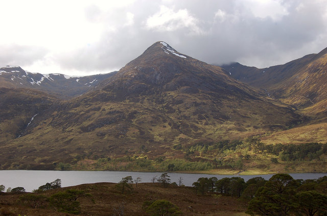
English: An Tudair from south side of Loch Affric. An Tudair is a spur running SE from the main ridge. Coire Leachavie is to the right and the waterfall of Sputan Ban, which drains Coire Coulavie, is on the left. |
| Data | |
| Funtana | From geograph.org.uk |
| Autur | Jim Barton |
| Atribuzion (richiesto dalla licenza) | Jim Barton / An Tudair from south side of Loch Affric / |
| Luogo dello scatto | | Posizione di questa e altre immagini su: OpenStreetMap |
|---|
_heading:315.00&language=lld)
| Posizione del soggetto | | Posizione di questa e altre immagini su: OpenStreetMap |
|---|
_heading:315.00&language=lld)
Lizënza

|
Questa immagine proviene dalla collezione del progetto Geograph. Vedi questa fotografia sul sito web di Geograph per visualizzare i dettagli relativi al fotografo. Il copyright di questa immagine appartiene a Jim Barton ed è pubblicata secondo i termini della licenza Creative Commons Attribuzione-Condividi allo stesso modo 2.0.
|
Questo file è disponibile in base alla licenza Creative Commons Attribuzione-Condividi allo stesso modo 2.0 Generico
Atribuzion: Jim Barton
- Tu ies liede:
- da spartì – per cupié, spartësc y manda l lëur
- da mudé – da adaté al lëur
- A chësta condizions:
- atribuzion – Tu mues atribué l lëur te la maniera che à spiegà l autëur o chël che à la lizënza (ma nia te na maniera che l smea che ëi te paiessa).
- fá na condivijiun tla medema manira – Sce te mudes o svilupeies chësc test, pudres mé spartì ora l lëur sota la medema lizënza o una che ti smea a chësta same or compatible license
Storia dl documënt
Druca sun na data/ëura per udëi l documënt coche l fo te chël mumënt.
| Data/Ëura | Miniatura | Grandëza | utënt | Cumentar | |
|---|---|---|---|---|---|
| atuel | 18:01, 27 fau 2011 | | 640 × 424 (69 KB) | GeographBot | == {{int:filedesc}} == {{Information |description={{en|1=An Tudair from south side of Loch Affric An Tudair is a spur running SE from the main ridge. Coire Leachavie is to the right and the waterfall of Sputan Ban, which drains Coire Coulavie, is on the l |
Coche l document ie stat adurvà
Chësta plata adroa chësc documënt:
Coche l documënt ie stat adurvà ntëur l mond
Ënghe chësta wikis adroa chësc documënt:
- Adurvà sun cy.wikipedia.org
- Adurvà sun www.wikidata.org