
File:Antarctica (4), Adelaide Island, Stonehouse Bay.JPG

Dimenjiuns de chësta odüda danfora:800 x 531 pixel. Autra resoluzions: 320 x 213 pixel | 640 x 425 pixel | 1 024 x 680 pixel | 1 280 x 850 pixel | 1 716 x 1 140 pixel.
Documënt uriginel (1 716 × 1 140 pixels, dimenjiun dl file: 449 KB, MIME type: image/jpeg)
,_Adelaide_Island,_Stonehouse_Bay.JPG)
Ressumé
| Descriziun |
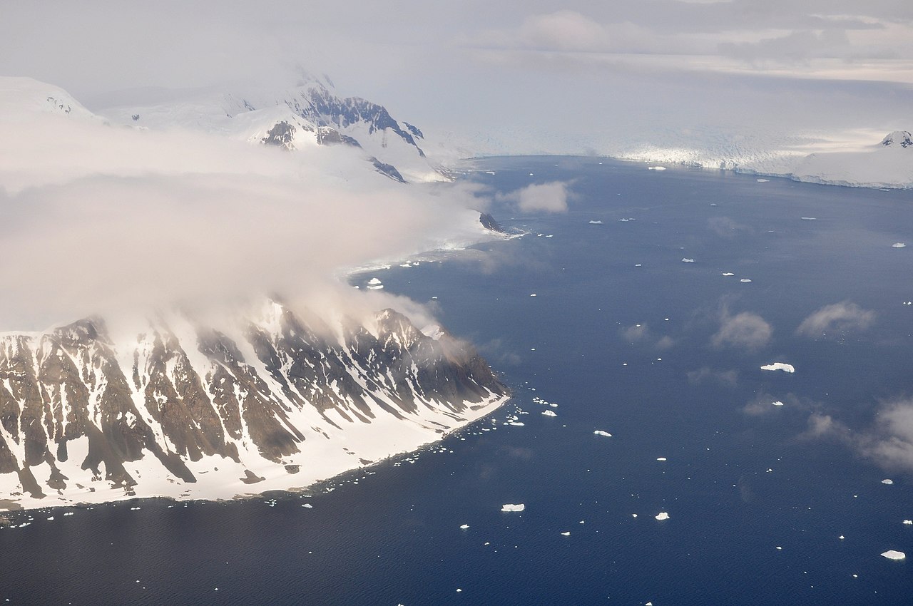
English: This picture is from the SW Antarctic Peninsula region.
It's an aerial view, looking West, from a position over Laubeuf Fjord to a part of Adelaide Island's east coast. In the foreground on the left is Sighing Peak, which forms the NE extremity of Adelaide Island's Wright Peninsula. The mountains behind it are the Stokes Peaks. The channel in front of Sighing Peak is called Cole Channel (and is actually a part of Laubeuf Fjord). The large body of water on the right is Stonehouse Bay. In the upper right hand corner of the picture, at the western end of Stonehouse Bay, is the huge and heavily crevassed Shambles Glacier; Adelaide Island's largest glacier. To the right of the glacier, at the extreme edge of the picture, is Dewar Nunatak. |
| Data | |
| Funtana | Opera personala |
| Autur | Vincent van Zeijst |
•
| Luogo dello scatto | | Posizione di questa e altre immagini su: OpenStreetMap |
|---|
,_Adelaide_Island,_Stonehouse_Bay.JPG¶ms=-67.398517_N_-067.872161_E_globe:Earth_type:camera_heading:270.00&language=lld)
Lizënza
Io, detentore del copyright su quest'opera, dichiaro di pubblicarla con la seguente licenza:
Chësc file á la lizënza de destribuziun aladô dla lizënza Creative Commons Attribution-Share Alike 3.0 Unported.
- Tu ies liede:
- da spartì – per cupié, spartësc y manda l lëur
- da mudé – da adaté al lëur
- A chësta condizions:
- atribuzion – Tu mues atribué l lëur te la maniera che à spiegà l autëur o chël che à la lizënza (ma nia te na maniera che l smea che ëi te paiessa).
- fá na condivijiun tla medema manira – Sce te mudes o svilupeies chësc test, pudres mé spartì ora l lëur sota la medema lizënza o una che ti smea a chësta same or compatible license
Storia dl documënt
Druca sun na data/ëura per udëi l documënt coche l fo te chël mumënt.
| Data/Ëura | Miniatura | Grandëza | utënt | Cumentar | |
|---|---|---|---|---|---|
| atuel | 00:29, 11 mer 2011 | | 1 716 × 1 140 (449 KB) | Loranchet | {{Information |Description ={{en|1=This picture is from the SW Antarctic Peninsula region. It's an aerial view, looking West, from a position over Laubeuf Fjord to a part of Adelaide Island's east coast. In the foreground on the left is Sighing Peak, w |
Coche l document ie stat adurvà
Chësta plata adroa chësc documënt:
Coche l documënt ie stat adurvà ntëur l mond
Ënghe chësta wikis adroa chësc documënt:
- Adurvà sun arz.wikipedia.org
- Adurvà sun azb.wikipedia.org
- Adurvà sun ceb.wikipedia.org
- Adurvà sun de.wikipedia.org
- Adurvà sun en.wikipedia.org
- Adurvà sun es.wikipedia.org
- Adurvà sun id.wikipedia.org
- Adurvà sun it.wikipedia.org
- Adurvà sun mk.wikipedia.org
- Adurvà sun nn.wikipedia.org
- Adurvà sun pl.wikipedia.org
- Adurvà sun sv.wikipedia.org
- Adurvà sun www.wikidata.org
- Adurvà sun zh.wikipedia.org
,_Adelaide_Island,_Stonehouse_Bay.JPG)