
File:Doyle Peak and Fremont Peak from the east side of Agassiz Peak.jpg

Dimenjiuns de chësta odüda danfora:800 x 600 pixel. Autra resoluzions: 320 x 240 pixel | 640 x 480 pixel | 1 024 x 767 pixel | 1 280 x 959 pixel | 2 560 x 1 919 pixel | 3 472 x 2 602 pixel.
Documënt uriginel (3 472 × 2 602 pixels, dimenjiun dl file: 3,82 MB, MIME type: image/jpeg)
Ressumé
| Descriziun |
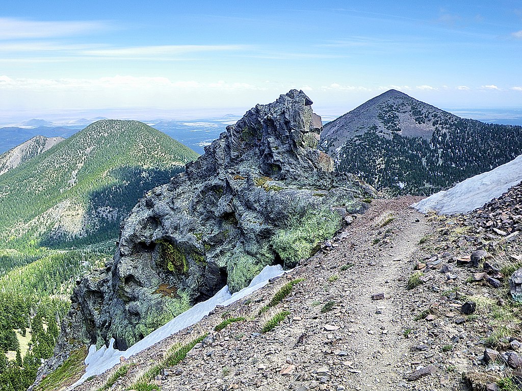
English: Doyle Peak and Fremont Peak in the San Francisco Peak of Arizona. I hiked from Lockett Meadow on the Inner Basin Trail to the Weatherford Trail to Humphrey's Summit in the San Francisco Peaks Wilderness north of Flagstaff Arizona. Looking southeast at Doyle Peak and Fremont Peak from the east side of Agassiz Peak. The Snowbowl is on the other side of Agassiz. |
| Data | |
| Funtana |
Alpine trail - San Francisco Peaks - Flagstaff AZ
|
| Autur | Alan English CPA from Scottsdale, Arizona 85254, USA |
| Luogo dello scatto | | Posizione di questa e altre immagini su: OpenStreetMap |
|---|
Lizënza
Questo file è disponibile in base alla licenza Creative Commons Attribuzione-Condividi allo stesso modo 2.0 Generico
- Tu ies liede:
- da spartì – per cupié, spartësc y manda l lëur
- da mudé – da adaté al lëur
- A chësta condizions:
- atribuzion – Tu mues atribué l lëur te la maniera che à spiegà l autëur o chël che à la lizënza (ma nia te na maniera che l smea che ëi te paiessa).
- fá na condivijiun tla medema manira – Sce te mudes o svilupeies chësc test, pudres mé spartì ora l lëur sota la medema lizënza o una che ti smea a chësta same or compatible license
| This image, originally posted to Flickr, was reviewed on February 19, 2011 by the administrator or reviewer File Upload Bot (Magnus Manske), who confirmed that it was available on Flickr under the stated license on that date. |
Storia dl documënt
Druca sun na data/ëura per udëi l documënt coche l fo te chël mumënt.
| Data/Ëura | Miniatura | Grandëza | utënt | Cumentar | |
|---|---|---|---|---|---|
| atuel | 22:35, 19 fau 2011 | | 3 472 × 2 602 (3,82 MB) | File Upload Bot (Magnus Manske) | {{Information |Description=I hiked from Lockett Meadow on the Inner Basin Trail to the Weatherford Trail to Humphrey's Summit in the San Francisco Peaks Wilderness north of Flagstaff Arizona. You can read the details of the hike at [http://hikearizona.co |
Coche l document ie stat adurvà
Chësta 2 plates adroa chësc documënt:
Coche l documënt ie stat adurvà ntëur l mond
Ënghe chësta wikis adroa chësc documënt:
- Adurvà sun arz.wikipedia.org
- Adurvà sun ceb.wikipedia.org
- Adurvà sun cs.wikipedia.org
- Adurvà sun en.wikipedia.org
- Adurvà sun en.wikivoyage.org
- Adurvà sun ur.wikipedia.org
- Adurvà sun www.wikidata.org