
File:Eaton canyon from the air.jpg
Eaton_canyon_from_the_air.jpg (688 × 457 pixels, dimenjiun dl file: 423 KB, MIME type: image/jpeg)
Ressumé
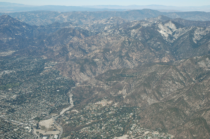
| Descriziun | Eaton Canyon, reservoir and wash from the air |
| Data | Scattata il 4 dezëmber 2005 |
| Funtana | Aerial Photography of Southern California |
| Autur | Bruce Perry |
| Altre versioni | http://www.cnsm.csulb.edu/departments/geology/people/bperry//Aerial%20Photos%20for%20Alumni%20Grant/San%20Gabriel%20Mountains%20Flight%20December%202005/San%20Gabriel%20Mountains%20Flight%201%20Dec%202005/214PasadenaEatonCanyonResAndWashDec05S.jpg |
| Luogo dello scatto | | Posizione di questa e altre immagini su: OpenStreetMap |
|---|
Lizënza
- Tu ies liede:
- da spartì – per cupié, spartësc y manda l lëur
- da mudé – da adaté al lëur
- A chësta condizions:
- atribuzion – Tu mues atribué l lëur te la maniera che à spiegà l autëur o chël che à la lizënza (ma nia te na maniera che l smea che ëi te paiessa).
- fá na condivijiun tla medema manira – Sce te mudes o svilupeies chësc test, pudres mé spartì ora l lëur sota la medema lizënza o una che ti smea a chësta same or compatible license
Errata
Credits - This web site was conceived of and produced by Bruce Perry of the Department of Geological Sciences at CSU Long Beach. If you have any questions or comments about the contents, please direct them to Mr. Perry at bperry@csulb.edu. All aerial and ground-based photographs are by Bruce Perry unless otherwise noted, and they can be used, with permission, for any nonprofit purpose.
Please credit photos to "Bruce Perry, Department of Geological Sciences, CSU Long Beach". For those wishing to use a photograph for business or other for-profit purpose, contact Mr. Perry for further information.
| Annotations | This image is annotated: View the annotations at Commons |
Storia dl documënt
Druca sun na data/ëura per udëi l documënt coche l fo te chël mumënt.
| Data/Ëura | Miniatura | Grandëza | utënt | Cumentar | |
|---|---|---|---|---|---|
| atuel | 02:48, 12 jun 2007 | | 688 × 457 (423 KB) | Evrik | {{Information |Description=Eaton Canyon, reservoir and wash from the air |Source=[http://www.cnsm.csulb.edu/departments/geology/people/bperry/Aerial%20Photography%20of%20Southern%20California/SanGabrielMountains.htm Aerial Photography |
Coche l document ie stat adurvà
Chësta plata adroa chësc documënt:
Coche l documënt ie stat adurvà ntëur l mond
Ënghe chësta wikis adroa chësc documënt:
- Adurvà sun azb.wikipedia.org
- Adurvà sun ca.wikipedia.org
- Adurvà sun ceb.wikipedia.org
- Adurvà sun ce.wikipedia.org
- Adurvà sun en.wikipedia.org
- Adurvà sun es.wikipedia.org
- Adurvà sun eu.wikipedia.org
- Adurvà sun fa.wikipedia.org
- Adurvà sun fi.wikipedia.org
- Adurvà sun fr.wikipedia.org
- Adurvà sun it.wikipedia.org
- Adurvà sun pl.wikipedia.org
- Adurvà sun pt.wikipedia.org
- Adurvà sun ru.wikipedia.org
- Adurvà sun sh.wikipedia.org
- Adurvà sun simple.wikipedia.org
- Adurvà sun sr.wikipedia.org
- Adurvà sun tt.wikipedia.org
- Adurvà sun uk.wikipedia.org
- Adurvà sun vo.wikipedia.org
- Adurvà sun www.wikidata.org
- Adurvà sun zh-min-nan.wikipedia.org
- Adurvà sun zh.wikipedia.org