
File:Falkland Islands location map.svg

Dimensioni di questa anteprima PNG per questo file SVG: 737 x 600 pixel. Autra resoluzions: 295 x 240 pixel | 590 x 480 pixel | 944 x 768 pixel | 1 258 x 1 024 pixel | 2 516 x 2 048 pixel | 1 134 x 923 pixel.
Documënt uriginel (file tl format SVG, dimenjiuns nominales 1 134 × 923 pixels, dimenjiun dl file: 138 KB)
Ressumé
| Descrizione |
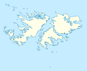
Deutsch: Positionskarte der Falklandinseln
Quadratische Plattkarte, N-S-Streckung 155 %. Geographische Begrenzung der Karte:
English: Location map of the Falkland Islands
Equirectangular projection, N/S stretching 155 %. Geographic limits of the map:
|
|||||||||
| Data | ||||||||||
| Funtana | own work, using United States National Imagery and Mapping Agency data | |||||||||
| Creatore | ||||||||||
| Geotemporal data | ||||||||||
| Bounding box |
|
|||||||||
| Georeferencing | If inappropriate please set warp_status = skip to hide. | |||||||||
| Altre versioni |
Derivative works of this file: |
|||||||||

|
Questa mappa è stata prodotta e/o migliorata nel Kartenwerkstatt, il laboratorio grafico della Wikipedia tedesca, dove è possible proporre mappe da migliorare.
|
Lizënza
Io, detentore del copyright su quest'opera, dichiaro di pubblicarla con le seguenti licenze:

|
AL é la lizënza da copié, da dé inant y/o müdé chësc documënt aladô dla lizënza GNU Free Documentation License, Verjiun 1.2 o vigni atra verjiun suandënta publicada dala Free Software Foundation; zënza seziuns che ara ne vá nia da mudé, zënza test söl cuertl ca dant y do ia. Na copia dla lizënza é tla seziun cun le titul Test dla GNU Free Documentation License. |
Questo file è disponibile in base alla licenza Creative Commons Attribuzione 3.0 Unported
- Tu ies liede:
- da spartì – per cupié, spartësc y manda l lëur
- da mudé – da adaté al lëur
- A chësta condizions:
- atribuzion – Tu mues atribué l lëur te la maniera che à spiegà l autëur o chël che à la lizënza (ma nia te na maniera che l smea che ëi te paiessa).
Pos chirí fora la lizënza che as plü ion
Storia dl documënt
Druca sun na data/ëura per udëi l documënt coche l fo te chël mumënt.
| Data/Ëura | Miniatura | Grandëza | utënt | Cumentar | |
|---|---|---|---|---|---|
| atuel | 14:00, 15 mer 2009 | | 1 134 × 923 (138 KB) | NordNordWest | {{Information |Description= {{de|Positionskarte der Falklandinseln}} Quadratische Plattkarte, N-S-Streckung 155 %. Geographische Begrenzung der Karte: * N: 50.9° S * S: 53.0° S * W: 61.5° W * O: 57.5° W {{en|Location map of the |
Coche l document ie stat adurvà
Chësta 19 plates adroa chësc documënt:
Coche l documënt ie stat adurvà ntëur l mond
Ënghe chësta wikis adroa chësc documënt:
- Adurvà sun af.wikipedia.org
- Adurvà sun an.wikipedia.org
- Adurvà sun ar.wikipedia.org
- Adurvà sun ast.wikipedia.org
- Adurvà sun az.wikipedia.org
- Adurvà sun ba.wikipedia.org
- Adurvà sun be-tarask.wikipedia.org
- Adurvà sun be.wikipedia.org
- Adurvà sun bg.wikipedia.org
- Adurvà sun bn.wikipedia.org
- Adurvà sun ca.wikipedia.org
- Adurvà sun ceb.wikipedia.org
- Plantilya:Location map United Kingdom Falkland Islands
- William Point
- Sandy Island
- Saddle Hill
- Rat Island
- Rabbit Island
- Low Bay
- Long Island
- Green Island
- Green Islet
- Goat Point
- Castle Hill
- Bird Island
- Mount Pleasant
- North Point
- Hospital Point
- Castle Rock
- West Point
- Little Island
- Black Point
- North Beach
- Sail Rock
- Black Rock
- High Rock
- Hut Point
- East Point
- Wolf Rock
- White Rock
- White Point
- Whale Point
Mostra utilisaziun globala de chësc file.