
File:Kanawha Ohio confluence.jpg

Dimenjiuns de chësta odüda danfora:751 x 600 pixel. Autra resoluzions: 301 x 240 pixel | 601 x 480 pixel | 962 x 768 pixel | 1 280 x 1 022 pixel | 1 500 x 1 198 pixel.
Documënt uriginel (1 500 × 1 198 pixels, dimenjiun dl file: 724 KB, MIME type: image/jpeg)
Ressumé
| Descriziun |
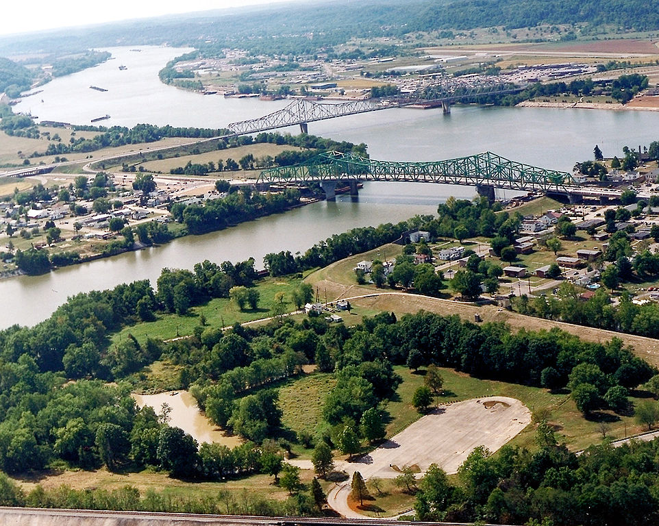
English: The confluence of the Kanawha and Ohio Rivers. The Kanawha River flows in from the left of the picture and joins the Ohio, meandering off in the distance. The town of Point Pleasant, West Virginia is in the foreground on the right. Henderson, West Virginia is on the left. The Ohio River forms the boundary between West Virginia and Ohio. The town of Gallipolis, Ohio lies in the far distance across the Ohio River. The view is to the west-southwest down the river. |
|||
| Data | prima del 2007 | |||
| Funtana |
U.S. Army Corps of Engineers Digital Visual Library Image page Image description page Digital Visual Library home page |
|||
| Autur | Charles Johnson, U.S. Army Corps of Engineers | |||
| Lizënza (Tó ca danü chësc file) |
|
|||
| Luogo | Point Pleasant, West Virginia, USA |
| Luogo dello scatto | | Posizione di questa e altre immagini su: OpenStreetMap |
|---|
| Annotations | This image is annotated: View the annotations at Commons |
Storia dl documënt
Druca sun na data/ëura per udëi l documënt coche l fo te chël mumënt.
| Data/Ëura | Miniatura | Grandëza | utënt | Cumentar | |
|---|---|---|---|---|---|
| atuel | 06:52, 23 mer 2007 | | 1 500 × 1 198 (724 KB) | DanMS | {{Information | Description = {{en|The confluence of the Kanawha and Ohio Rivers. The Kanawha River flows in from the left of the picture and joins the Ohio, meandering off in the distance. The town of Point Pleasant, West Virginia is in the foreground |
Coche l document ie stat adurvà
Chësta 2 plates adroa chësc documënt:
Coche l documënt ie stat adurvà ntëur l mond
Ënghe chësta wikis adroa chësc documënt:
- Adurvà sun ar.wikipedia.org
- Adurvà sun arz.wikipedia.org
- Adurvà sun ca.wikipedia.org
- Adurvà sun ceb.wikipedia.org
- Adurvà sun ce.wikipedia.org
- Adurvà sun cy.wikipedia.org
- Adurvà sun dag.wikipedia.org
- Adurvà sun de.wikipedia.org
- Adurvà sun en.wikipedia.org
- Adurvà sun en.wikivoyage.org
- Adurvà sun es.wikipedia.org
- Adurvà sun eu.wikipedia.org
- Adurvà sun fa.wikipedia.org
- Adurvà sun fr.wikipedia.org
- Adurvà sun hu.wikipedia.org
- Adurvà sun it.wikipedia.org
- Adurvà sun ja.wikipedia.org
- Adurvà sun ko.wikipedia.org
- Adurvà sun kw.wikipedia.org
- Adurvà sun no.wikipedia.org
- Adurvà sun pl.wikipedia.org
- Adurvà sun pt.wikipedia.org
- Adurvà sun ro.wikipedia.org
- Adurvà sun ru.wikipedia.org
- Adurvà sun sh.wikipedia.org
- Adurvà sun simple.wikipedia.org
- Adurvà sun sr.wikipedia.org
- Adurvà sun tt.wikipedia.org
Mostra utilisaziun globala de chësc file.