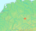
File:Location Fichtelgebirge.PNG
Location_Fichtelgebirge.PNG (506 × 439 pixels, dimenjiun dl file: 40 KB, MIME type: image/png)
Storia dl documënt
Druca sun na data/ëura per udëi l documënt coche l fo te chël mumënt.
| Data/Ëura | Miniatura | Grandëza | utënt | Cumentar | |
|---|---|---|---|---|---|
| atuel | 15:42, 29 jun 2007 |  | 506 × 439 (40 KB) | Michiel1972 | {{Information |Description=Locator maps for mountain ranges : {{subst:PAGENAME}} |Source=demis maps, see below |Date= |Author={{Statistics Netherlands map}} |Permission=see below |other_versions= }} {{PD-Demis}} [[Category:Maps of mountain_ranges_of_Eu |
Coche l document ie stat adurvà
Chësta plata adroa chësc documënt:
Coche l documënt ie stat adurvà ntëur l mond
Ënghe chësta wikis adroa chësc documënt:
- Adurvà sun bg.wikipedia.org
- Adurvà sun ca.wikipedia.org
- Adurvà sun ceb.wikipedia.org
- Adurvà sun de.wikivoyage.org
- Adurvà sun en.wikivoyage.org
- Adurvà sun eo.wikipedia.org
- Adurvà sun fy.wikipedia.org
- Adurvà sun nl.wikipedia.org
- Adurvà sun nn.wikipedia.org
- Adurvà sun ru.wikipedia.org
- Adurvà sun www.wikidata.org
