
File:Mount Pleasant Historic Site.jpg
Dimenjiuns de chësta odüda danfora:800 x 402 pixel. Autra resoluzions: 320 x 161 pixel | 640 x 322 pixel | 1 024 x 515 pixel | 1 280 x 644 pixel | 2 060 x 1 036 pixel.
Documënt uriginel (2 060 × 1 036 pixels, dimenjiun dl file: 416 KB, MIME type: image/jpeg)
|
Questa è un'immagine di un luogo o edificio che è elencato nel National Register of Historic Places negli Stati Uniti. Il suo numero di riferimento è [https://npgallery.nps.gov/AssetDetail/NRIS/74001536
. 74001536
.]. |
Ressumé
| Descriziun |
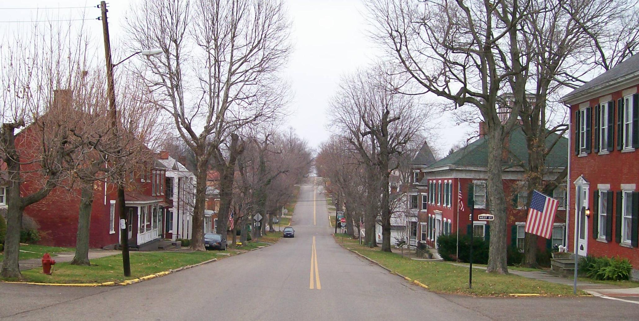
English: The Mount Pleasant Historic District in Ohio looking east along Union Street from its junction with Market Street. The district was added to the National Register of Historic Places in 1974 for national significance in the abolitionist movement including being a stop on the Underground Railroad and intact architectural integrity. Taken on 2009-11-21. |
| Data | (UTC) |
| Funtana |
I (Bwsmith84 (talk)) created this work entirely by myself. Transferred from en.wikipedia |
| Autur | Bwsmith84 (talk) |
| Lizënza (Tó ca danü chësc file) |
Bwsmith84 at en.wikipedia, detentore del copyright su quest'opera, dichiara di pubblicarla con la seguente licenza: Questo file è disponibile in base alla licenza Creative Commons Attribuzione 3.0 Unported Atribuzion: Bwsmith84 at en.wikipedia
|
| Posizione del soggetto | | Posizione di questa e altre immagini su: OpenStreetMap |
|---|
Registro originale del caricamento
The original description page was here. All following user names refer to en.wikipedia.
- 2009-11-21 22:33 Bwsmith84 2060×1036 (425814 bytes) {{Information |Description = The Mount Plesant Historic Site looking from Market Street to the east. |Source = I (~~~) created this work entirely by myself. |Date = ~~~~~ |Author = ~~~ |other_versions = }}
Storia dl documënt
Druca sun na data/ëura per udëi l documënt coche l fo te chël mumënt.
| Data/Ëura | Miniatura | Grandëza | utënt | Cumentar | |
|---|---|---|---|---|---|
| atuel | 11:42, 9 jen 2012 | | 2 060 × 1 036 (416 KB) | BotMultichillT | {{BotMoveToCommons|en.wikipedia|year={{subst:CURRENTYEAR}}|month={{subst:CURRENTMONTHNAME}}|day={{subst:CURRENTDAY}}}} == {{int:filedesc}} == {{Information |description={{en|1=The Mount Pleasant Historic District in Ohio looking east along Union Street f |
Coche l document ie stat adurvà
Chësta plata adroa chësc documënt:
Coche l documënt ie stat adurvà ntëur l mond
Ënghe chësta wikis adroa chësc documënt:
- Adurvà sun ar.wikipedia.org
- Adurvà sun ca.wikipedia.org
- Adurvà sun ceb.wikipedia.org
- Adurvà sun cy.wikipedia.org
- Adurvà sun en.wikipedia.org
- Adurvà sun es.wikipedia.org
- Adurvà sun eu.wikipedia.org
- Adurvà sun fr.wikipedia.org
- Adurvà sun ht.wikipedia.org
- Adurvà sun it.wikipedia.org
- Adurvà sun pl.wikipedia.org
- Adurvà sun pt.wikipedia.org
- Adurvà sun sh.wikipedia.org
- Adurvà sun sr.wikipedia.org
- Adurvà sun uk.wikipedia.org
- Adurvà sun vi.wikipedia.org
- Adurvà sun www.wikidata.org
- Adurvà sun zh-min-nan.wikipedia.org