
File:OHMap-doton-Brandt.png
Degöna resoluziun plü alta desponibla.
OHMap-doton-Brandt.png (309 × 352 pixels, dimenjiun dl file: 17 KB, MIME type: image/png)
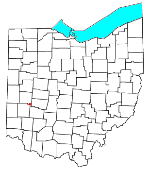
| Descriziun | Locator map of the unincorporated community of Brandt in Miami County, Ohio, United States. | ||
| Data | |||
| Funtana | Modified from this United States Census Bureau file. | ||
| Autur | User:Nyttend | ||
| Lizënza (Tó ca danü chësc file) |
US Government work is public domain, and my work is
|
Storia dl documënt
Druca sun na data/ëura per udëi l documënt coche l fo te chël mumënt.
| Data/Ëura | Miniatura | Grandëza | utënt | Cumentar | |
|---|---|---|---|---|---|
| atuel | 16:08, 13 uto 2007 | | 309 × 352 (17 KB) | Nyttend | {{Information |Description=Locator map of the {{w|unincorporated area|unincorporated community}} of {{w|Brandt, Ohio|Brandt}} in {{w|Miami County, Ohio|Miami County}}, {{w|Ohio}}, {{w|United States}}. |Source=Modified from [http://www2.census.gov/geo/maps |
Coche l document ie stat adurvà
Chësta plata adroa chësc documënt:
Coche l documënt ie stat adurvà ntëur l mond
Ënghe chësta wikis adroa chësc documënt:
- Adurvà sun en.wikipedia.org
- Adurvà sun www.wikidata.org