
File:Singapore location map (main island).svg

Dimensioni di questa anteprima PNG per questo file SVG: 800 x 508 pixel. Autra resoluzions: 320 x 203 pixel | 640 x 406 pixel | 1 024 x 650 pixel | 1 280 x 812 pixel | 2 560 x 1 625 pixel | 3 247 x 2 061 pixel.
Documënt uriginel (file tl format SVG, dimenjiuns nominales 3 247 × 2 061 pixels, dimenjiun dl file: 309 KB)
.svg)
Ressumé
| Descriziun |
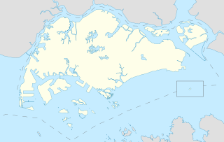
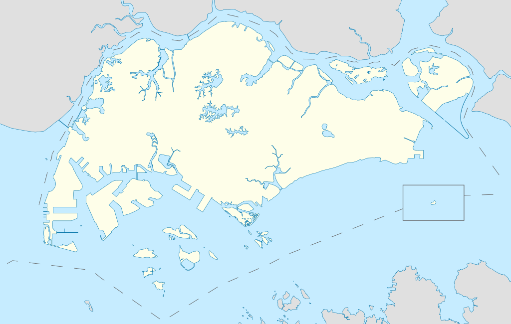
English: Locator Map for Singapore's main island, with Pedra Branca as an insert |
| Data | |
| Funtana | Opera personala |
| Autur | Seloloving |
Lizënza
Io, detentore del copyright su quest'opera, dichiaro di pubblicarla con la seguente licenza:
Questo file è disponibile in base alla licenza Creative Commons Attribuzione-Condividi allo stesso modo 4.0 Internazionale
- Tu ies liede:
- da spartì – per cupié, spartësc y manda l lëur
- da mudé – da adaté al lëur
- A chësta condizions:
- atribuzion – Tu mues atribué l lëur te la maniera che à spiegà l autëur o chël che à la lizënza (ma nia te na maniera che l smea che ëi te paiessa).
- fá na condivijiun tla medema manira – Sce te mudes o svilupeies chësc test, pudres mé spartì ora l lëur sota la medema lizënza o una che ti smea a chësta same or compatible license
Storia dl documënt
Druca sun na data/ëura per udëi l documënt coche l fo te chël mumënt.
| Data/Ëura | Miniatura | Grandëza | utënt | Cumentar | |
|---|---|---|---|---|---|
| atuel | 13:16, 14 jun 2020 | | 3 247 × 2 061 (309 KB) | Seloloving | added maritime borders |
| 11:36, 13 jun 2020 |  | 3 247 × 2 061 (310 KB) | Seloloving | full extent of singapore and claimed waters | |
| 20:36, 10 jun 2020 |  | 2 959 × 1 949 (224 KB) | Seloloving | Uploaded own work with UploadWizard |
Coche l document ie stat adurvà
L ne da deguna plates che adroa chësc documënt.
Coche l documënt ie stat adurvà ntëur l mond
Ënghe chësta wikis adroa chësc documënt:
- Adurvà sun bcl.wikipedia.org
- Adurvà sun en.wikipedia.org
- Jurong
- Jurong Island
- Pulau Tekong
- Changi
- Changi Naval Base
- Ang Mo Kio
- Changi Prison
- Sembawang
- Pulau Ubin
- Paya Lebar Air Base
- Geylang
- Sakya Muni Buddha Gaya Temple
- Punggol
- Woodlands, Singapore
- Marine Parade
- Clementi, Singapore
- Pasir Ris
- Orchard Road
- Kallang
- Choa Chu Kang
- Paya Lebar
- Republic of Singapore Navy
- Singapore Army
- Tampines
- Bukit Timah
- Yishun
- Marsiling
- Serangoon
- Bishan, Singapore
- Lim Chu Kang
- Bukit Batok
- Bukit Panjang
- Hougang
- Queenstown, Singapore
- Toa Payoh
- Tuas
- Former National Stadium, Singapore
- 1984 AFC Asian Cup
- Bedok
- Kong Meng San Phor Kark See Monastery
- Seletar
- Pulau Brani
- Kusu Island
- Sisters' Islands
- Pulau Hantu
Mostra utilisaziun globala de chësc file.
.svg)
.svg)