
File:St Anne's Church, Whitstone - geograph.org.uk - 144342.jpg
Degöna resoluziun plü alta desponibla.
St_Anne's_Church,_Whitstone_-_geograph.org.uk_-_144342.jpg (640 × 480 pixels, dimenjiun dl file: 101 KB, MIME type: image/jpeg)
Ressumé
| Descriziun |
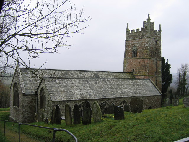
English: St Anne's Church, Whitstone. Taken from the NE entrance to the churchyard. An ancient wellhouse is in the SE corner of the churchyard. An old stone face stares out from the rear of the well. |
| Data | |
| Funtana | From geograph.org.uk |
| Autur | Alan Simkins |
| Atribuzion (richiesto dalla licenza) | Alan Simkins / St Anne's Church, Whitstone / |
| Posizione del soggetto | | Posizione di questa e altre immagini su: OpenStreetMap |
|---|
_&language=lld)
Lizënza

|
Questa immagine proviene dalla collezione del progetto Geograph. Vedi questa fotografia sul sito web di Geograph per visualizzare i dettagli relativi al fotografo. Il copyright di questa immagine appartiene a Alan Simkins ed è pubblicata secondo i termini della licenza Creative Commons Attribuzione-Condividi allo stesso modo 2.0.
|
Questo file è disponibile in base alla licenza Creative Commons Attribuzione-Condividi allo stesso modo 2.0 Generico
Atribuzion: Alan Simkins
- Tu ies liede:
- da spartì – per cupié, spartësc y manda l lëur
- da mudé – da adaté al lëur
- A chësta condizions:
- atribuzion – Tu mues atribué l lëur te la maniera che à spiegà l autëur o chël che à la lizënza (ma nia te na maniera che l smea che ëi te paiessa).
- fá na condivijiun tla medema manira – Sce te mudes o svilupeies chësc test, pudres mé spartì ora l lëur sota la medema lizënza o una che ti smea a chësta same or compatible license
Storia dl documënt
Druca sun na data/ëura per udëi l documënt coche l fo te chël mumënt.
| Data/Ëura | Miniatura | Grandëza | utënt | Cumentar | |
|---|---|---|---|---|---|
| atuel | 11:47, 31 jen 2010 | | 640 × 480 (101 KB) | GeographBot | == {{int:filedesc}} == {{Information |description={{en|1=St Anne's Church, Whitstone. Taken from the NE entrance to the churchyard. An ancient wellhouse is in the SE corner of the churchyard. An old stone face stares out from the rear of the well.}} |date |
Coche l document ie stat adurvà
Chësta plata adroa chësc documënt:
Coche l documënt ie stat adurvà ntëur l mond
Ënghe chësta wikis adroa chësc documënt:
- Adurvà sun arz.wikipedia.org
- Adurvà sun ceb.wikipedia.org
- Adurvà sun cy.wikipedia.org
- Adurvà sun dag.wikipedia.org
- Adurvà sun en.wikipedia.org
- Adurvà sun eu.wikipedia.org
- Adurvà sun fr.wikipedia.org
- Adurvà sun sv.wikipedia.org
- Adurvà sun www.wikidata.org