
File:The Ship Keyingham.jpg
The_Ship_Keyingham.jpg (640 × 474 pixels, dimenjiun dl file: 81 KB, MIME type: image/jpeg)
Ressumé
| Descriziun |
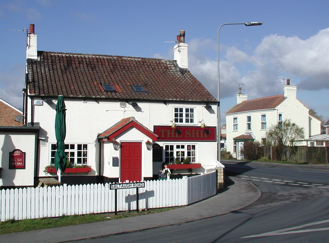
English: The Ship, Keyingham, East Riding of Yorkshire, England. This unassumingly named pub on the corner of Saltaugh Road and Main Street gets its title from one fleeting moment when the village of Keyingham was of some interest to historians.
|
| Data | |
| Funtana | From geograph.org.uk |
| Autur | Paul Glazzard |
| Lizënza (Tó ca danü chësc file) |
Creative Commons Attribution Share-alike license 2.0 |
| Atribuzion (richiesto dalla licenza) | Paul Glazzard / The Ship, Keyingham / |
| Luogo dello scatto | | Posizione di questa e altre immagini su: OpenStreetMap |
|---|
Lizënza

|
Questa immagine proviene dalla collezione del progetto Geograph. Vedi questa fotografia sul sito web di Geograph per visualizzare i dettagli relativi al fotografo. Il copyright di questa immagine appartiene a Paul Glazzard ed è pubblicata secondo i termini della licenza Creative Commons Attribuzione-Condividi allo stesso modo 2.0.
|
- Tu ies liede:
- da spartì – per cupié, spartësc y manda l lëur
- da mudé – da adaté al lëur
- A chësta condizions:
- atribuzion – Tu mues atribué l lëur te la maniera che à spiegà l autëur o chël che à la lizënza (ma nia te na maniera che l smea che ëi te paiessa).
- fá na condivijiun tla medema manira – Sce te mudes o svilupeies chësc test, pudres mé spartì ora l lëur sota la medema lizënza o una che ti smea a chësta same or compatible license
Storia dl documënt
Druca sun na data/ëura per udëi l documënt coche l fo te chël mumënt.
| Data/Ëura | Miniatura | Grandëza | utënt | Cumentar | |
|---|---|---|---|---|---|
| atuel | 21:35, 10 fau 2010 | | 640 × 474 (81 KB) | Keith D | == {{int:filedesc}} == {{Information |Description={{en|1=The Ship, Keyingham, East Riding of Yorkshire.<br />This unassumingly named pub on the corner of Saltaugh Road and Main Street gets its title from |
Coche l document ie stat adurvà
Chësta plata adroa chësc documënt:
Coche l documënt ie stat adurvà ntëur l mond
Ënghe chësta wikis adroa chësc documënt:
- Adurvà sun ang.wikipedia.org
- Adurvà sun ceb.wikipedia.org
- Adurvà sun en.wikipedia.org
- Adurvà sun es.wikipedia.org
- Adurvà sun fr.wikipedia.org
- Adurvà sun pl.wikipedia.org
- Adurvà sun sv.wikipedia.org
- Adurvà sun www.wikidata.org