
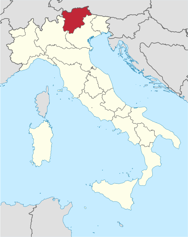
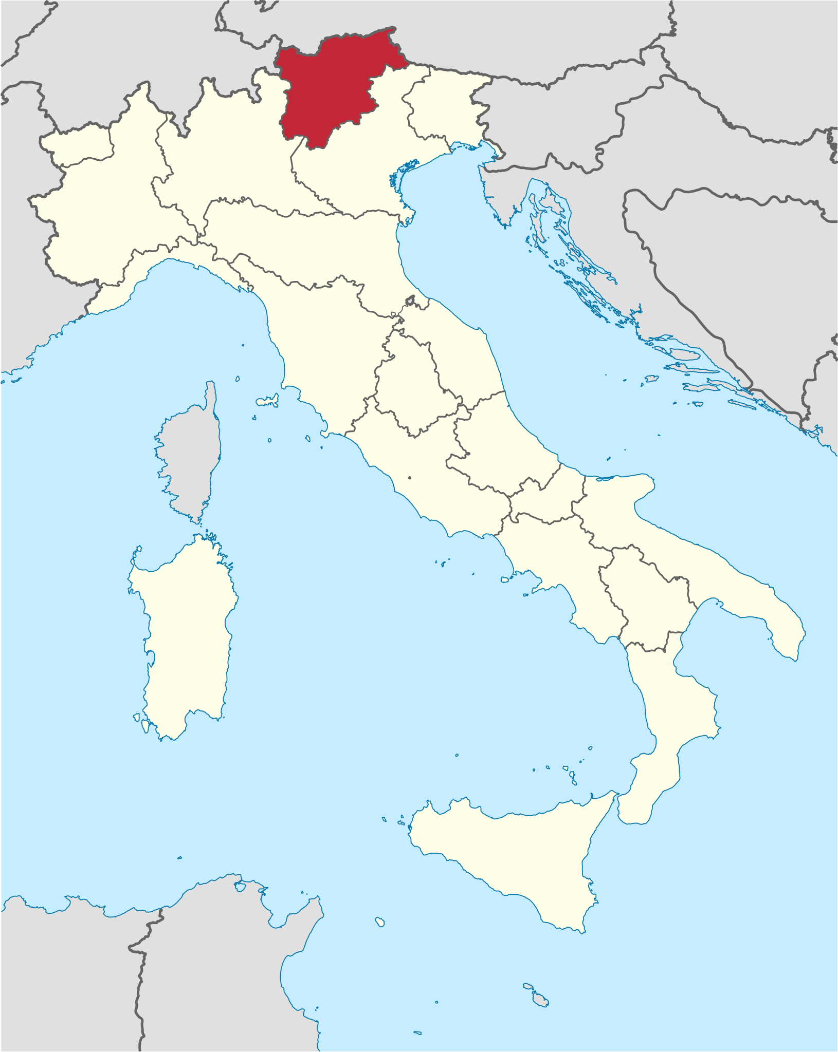
File:Trentino-Alto Adige in Italy.svg

Dimensioni di questa anteprima PNG per questo file SVG: 477 x 599 pixel. Autra resoluzions: 191 x 240 pixel | 382 x 480 pixel | 611 x 768 pixel | 815 x 1 024 pixel | 1 630 x 2 048 pixel | 1 034 x 1 299 pixel.
Documënt uriginel (file tl format SVG, dimenjiuns nominales 1 034 × 1 299 pixels, dimenjiun dl file: 1,67 MB)
Ressumé
.svg)
.svg)
.svg)
.svg)
.svg)
.svg)
.svg)

-en.svg)

.svg)
.svg)
.svg)

_(US48).svg)
_(small_islands_magnified)_(-mini_map_-rivers).svg)
.svg)
_(extra_close)_(US48).svg)
.svg)
_(zoom).svg)

.svg)


_(UNMIK).svg)
.svg)
_(disputed_hatched).svg)
_(claimed_and_disputed_hatched).svg)
.svg)
.svg)
_(%2Ball_claims_hatched).svg)

.svg)
_(shade).svg)
_(shade)_(special_marker).svg)
_(-mini_map).svg)
_(-mini_map).svg)
_(-mini_map).svg)


.svg)

.svg)

Lizënza
Io, detentore del copyright su quest'opera, dichiaro di pubblicarla con le seguenti licenze:

|
AL é la lizënza da copié, da dé inant y/o müdé chësc documënt aladô dla lizënza GNU Free Documentation License, Verjiun 1.2 o vigni atra verjiun suandënta publicada dala Free Software Foundation; zënza seziuns che ara ne vá nia da mudé, zënza test söl cuertl ca dant y do ia. Na copia dla lizënza é tla seziun cun le titul Test dla GNU Free Documentation License. |
Chësc file á la lizënza de destribuziun aladô dla lizënza Creative Commons Attribution-Share Alike 3.0 Unported.
- Tu ies liede:
- da spartì – per cupié, spartësc y manda l lëur
- da mudé – da adaté al lëur
- A chësta condizions:
- atribuzion – Tu mues atribué l lëur te la maniera che à spiegà l autëur o chël che à la lizënza (ma nia te na maniera che l smea che ëi te paiessa).
- fá na condivijiun tla medema manira – Sce te mudes o svilupeies chësc test, pudres mé spartì ora l lëur sota la medema lizënza o una che ti smea a chësta same or compatible license
Pos chirí fora la lizënza che as plü ion

|
I'd greatly appreciate, that you attribute this media file to Wikimedia Commons, if used outside Wikipedia or Commons. For use in publications such as books, newspapers, blogs, websites, please insert here the following line:
|
Storia dl documënt
Druca sun na data/ëura per udëi l documënt coche l fo te chël mumënt.
| Data/Ëura | Miniatura | Grandëza | utënt | Cumentar | |
|---|---|---|---|---|---|
| atuel | 20:07, 17 jun 2011 | | 1 034 × 1 299 (1,67 MB) | Foroa | Reverted to version as of 13:40, 17 June 2011 |
| 19:49, 17 jun 2011 |  | 1 034 × 1 299 (1,68 MB) | Gryffindor | Reverted to version as of 12:50, 17 June 2011 | |
| 15:40, 17 jun 2011 |  | 1 034 × 1 299 (1,67 MB) | TUBS | rv: [http://commons.wikimedia.org/wiki/User_talk:Gryffindor#File:Trentino-Alto_Adige_in_Italy.svg] | |
| 14:50, 17 jun 2011 |  | 1 034 × 1 299 (1,68 MB) | Gryffindor | Reverted to version as of 23:28, 15 June 2011 the depiction of the provinces is in order as they are de-facto regions | |
| 08:21, 16 jun 2011 |  | 1 034 × 1 299 (1,67 MB) | TUBS | Reverted to version as of 06:49, 14 June 2011. Please save as a new file. Borders shouldn't differ in that map series | |
| 01:28, 16 jun 2011 |  | 1 034 × 1 299 (1,68 MB) | Gryffindor | Reverted to version as of 20:15, 13 June 2011 both are autonomous provinces in an autonomous region, others do not have that | |
| 08:49, 14 jun 2011 |  | 1 034 × 1 299 (1,67 MB) | TUBS | Reverted to version as of 12:27, 7 March 2011: please give new filename and move to new category. doesn't make sense: other province borders aren' shown either | |
| 22:15, 13 jun 2011 |  | 1 034 × 1 299 (1,68 MB) | Kmusser | add province boundary | |
| 14:27, 7 mer 2011 |  | 1 034 × 1 299 (1,67 MB) | TUBS |
Coche l document ie stat adurvà
Chësta plata adroa chësc documënt:
Coche l documënt ie stat adurvà ntëur l mond
Ënghe chësta wikis adroa chësc documënt:
- Adurvà sun als.wikipedia.org
- Adurvà sun ar.wikipedia.org
- Adurvà sun ast.wikipedia.org
- Adurvà sun az.wikipedia.org
- Adurvà sun bcl.wikipedia.org
- Adurvà sun bg.wikipedia.org
- Adurvà sun ca.wikipedia.org
- Adurvà sun ceb.wikipedia.org
- Adurvà sun co.wikipedia.org
- Adurvà sun crh.wikipedia.org
- Adurvà sun cs.wikipedia.org
- Adurvà sun cy.wikipedia.org
- Adurvà sun de.wikipedia.org
- Adurvà sun de.wikivoyage.org
- Adurvà sun diq.wikipedia.org
- Adurvà sun el.wikipedia.org
- Adurvà sun en.wikipedia.org
- Adurvà sun eo.wikivoyage.org
- Adurvà sun fi.wikipedia.org
- Adurvà sun frr.wikipedia.org
- Adurvà sun fr.wikipedia.org
- Adurvà sun fr.wiktionary.org
- Adurvà sun ga.wikipedia.org
- Adurvà sun gd.wikipedia.org
- Adurvà sun gl.wikipedia.org
- Adurvà sun ia.wikipedia.org
- Adurvà sun id.wikipedia.org
- Adurvà sun incubator.wikimedia.org
- Adurvà sun it.wikipedia.org
- Adurvà sun it.wikivoyage.org
- Adurvà sun jam.wikipedia.org
- Adurvà sun kab.wikipedia.org
- Adurvà sun ko.wikipedia.org
- Adurvà sun la.wikipedia.org
- Adurvà sun lb.wikipedia.org
- Adurvà sun lij.wikipedia.org
- Adurvà sun lmo.wikipedia.org
- Adurvà sun lv.wikipedia.org
Mostra utilisaziun globala de chësc file.