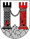
Schrattenthal
Aspetto
| Articul per Ladin Gherdëina |
 | |
| Schrattenthal | |
|---|---|
 | |
| Nfurmazions prinzipeles | |
| Stat | |
| Stat federel | |
| Raion | Hollabrunn |
| Populazion | 868 ab. (1 jené 2018) |
| Densità | 38,7 ab./km² |
| Geografia | |
| Coordinedes | 48°43′N 15°54′E / 48.717°N 15.900°E |
| Autëza | 289 m sëura l livel dl mer |
| Spersa | 22,4 km² |
| Auter | |
| Gemeindekennziffer | 31041 |
| Codesc de la posta | 2073 |
| Prefis dl telefon | 02942 |
| Targa de l'auto | HL |
| Plata internet | schrattenthal |
| Cherta | |
Schrattenthal ie n chemun de l'Austria tl raion Hollabrunn dl stat federel Austria Bassa. Ai 1 de jené 2022 ovel na populazion de 893 sun na spersa de 22,44 km².[1]
Geografia
[mudé | muda l codesc]Storia
[mudé | muda l codesc]Referënzes
[mudé | muda l codesc]- ↑ "Einwohnerzahl 1.1.2018 nach Gemeinden mit Status, Gebietsstand 1.1.2018". Trat ite ai 9 merz 2019.

